
American Battlefield Trust
Originally published November 2023 · pp. 20–21
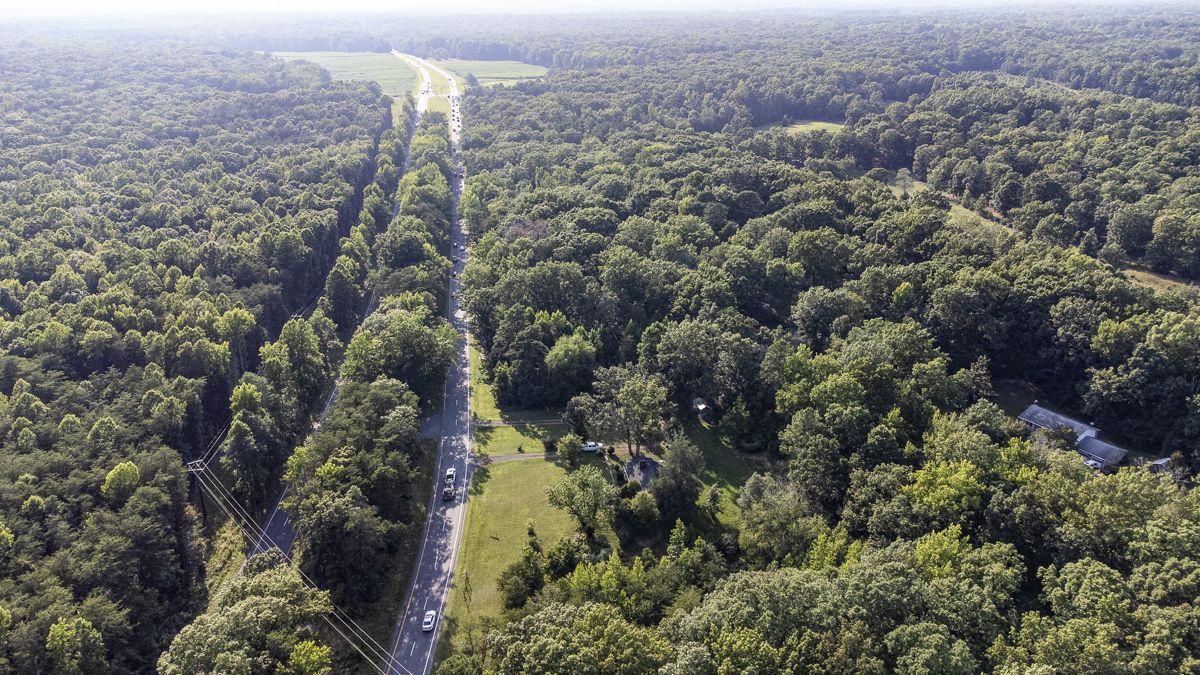
The site where both the battles of Gaines’ Mill and Cold Harbor were fought remains one of the most hallowed battlefields in the country. Over the past three years, the Trust has achieved and surpassed significant milestones with its “Gaines’ MillCold Harbor Saved Forever” campaign. Impressive progress has been made in preserving land during the first three phases: “Pickett’s Charge Five Times as Large” in Phase 1, “The Intersection” in Phase 2, and “The Juncture at Griffin’s Woods” in Phase 3. In tandem with these phases, the Trust recently launched Phase 4, aiming to preserve more than 332 acres at Gaines’ Mill-Cold Harbor, along with 12 acres at Seven Pines. Altogether, the combined 344 acres at Gaines’ Mill and Seven Pines have a transaction value of $1.085 million. With generous donations from major donors and anticipated state and federal grants, the Trust is working seeks to finally share the story of this pivotal battle. To learn more, visit w w w. b a t t l e f i e l d s . o rg / g i v e / save-battlefields.
3.5-mile protected battlefield land corridor. This campaign also marks a first-time preservation effort at Seven Pines, where the Trust aims to protect 12 acres. The Battle of Seven Pines, fought over two days during the Peninsula Campaign, resulted in heavy casualties for both sides and led to Gen. Robert E. Lee replacing Joseph E. Johnston due to his wounds. Unfortunately, much of the battlefield has succumbed to commercial and residential development, leaving only a few historic markers along modern interstates to trace the battle’s history. By preserving these 12 acres at Seven Pines, the Trust
Stave off Development at Chancellorsville Battlefield Chancellorsville is no stranger to development threats, facing a host of challenging situations over the past two decades. Collaborative efforts with elected officials and developers achieved win-win solutions, preserving key parts of the First Day at Chancellorsville area, which has since remained a cherished community asset replete with walking trails and housing the Spotsylvania County Museum. Now, however, Chancellorsville is at a pivotal crossroads as Spotsylvania County is considering a special use permit for a gas station, convenience store, and a professional complex. The proposed development site lies at the very heart of the battlefield, where some of the most intense fighting occurred during the Civil War. This project carries the potential to open up the eastern part of the battlefield to further commercial development, posing a significant threat to this hallowed ground. The 10-acre parcel currently at risk resides within a mere 1,500 feet of the intersection bearing the name of one of the Civil War’s bloodiest battles. Central to the battlefield’s history, this piece of land was occupied by Federal troops and subsequently faced an assault by elements of Confederate Gen. Lafayette McLaw’s Division on the morning of May 3, 1863. This property has been classified as core battlefield territory and contains a substantial portion within the legislatively authorized boundary of the Fredericksburg and Spotsylvania National Military Park. Additionally, the battlefield land is eligible for
Help Save 332 Acres at Gaines’ Mill– Cold Harbor towards raising the remaining $506,047. The 332-acre tract at Gaines’ Mill and Cold Harbor extends from the Chickahominy River northward, connecting with the Richmond National Battlefield Park, alongside other previously preserved tracts. Securing this area would create a contiguous

CivilWarNews.com the National Register of Historic Places, among other recognitions. The introduction of a gas station, convenience store, and other professional businesses at this site would irrevocably transform the landscape of both the immediate vicinity and its surrounding areas, altering the historic fabric of the region forever. To learn more about this threat or to sign a petition announcing your opposition against the development, please visit www. b a t t l e f i e l d s . o rg / s p e a k - o u t / protect-heart-chancellorsvillebattlefield.
Traverse the Chickamauga and Chattanooga Battlefields Marking the 160th anniversary of the Battle of Chickamauga, the Trust recently premiered a video driving tour of the Chickamauga Battlefield. The 90-minute video guides viewers through the Chickamauga and Chattanooga National Military Park, demonstrating the power of place at the site of the secondbloodiest battle of the Civil War. This video is part of a collection of free digital resources, which includes 23 mobile apps and over 1,000 videos hosted on the Trust’s YouTube channel. In continuing similar releases for the Gettysburg and Shiloh battlefields, the Chickamauga video tour joins these videos, which together have garnered more than 1 million views on YouTube. The video, created in coordination with the National Park Service, provides audiences, whether near or far, with an opportunity to explore the first federally created military park in the United States. Historian David A. Powell, author of nine books on the battles of Chickamauga and Chattanooga, takes the wheel as he navigates viewers through the site’s most captivating locations, with GoPro cameras mounted on a vehicle. The video is enriched with on-screen maps, historic imagery, and immersive out-ofthe-car experiences. “Chickamauga 160: A Guided Tour of the Chickamauga Battlefield” is now available on the Trust’s YouTube channel.
Journey Through America’s Wars from 1754 to 1945 With its most ambitious animated battle map to date, the Trust recently launched its “America’s Wars 1754-1945”. The video, produced by the award-winning Wide Awake Films, depicts the pivotal events and engagements that shaped the
United States, spanning from the outset of the French and Indian War to the conclusion of World War II. This nearly hour-long production seamlessly blends dramatic narration, historic and modern images, motion graphics, reenactment footage, music, and more to breathe life into the stories of these conflicts. These include the Revolutionary War, Indian Wars, Mexican-American War, Civil War, SpanishAmerican War, World War I, and World War II. This video is the latest addition to the Trust’s extensive series of animated map videos, totaling two dozen in all, which have garnered more than 20 million views. The Animated Maps collection is dedicated to shedding light on individual battles or campaigns from the Revolutionary War, War of 1812, and Civil War. The “America’s Wars 1754-1945 Animated Map” video is available on the Trust’s YouTube channel.
Victory Declared on 150 Acres of Maryland Campaign Battlefield Land Commemorating the 161st anniversary of the Battle of Antietam, the Trust recently declared victory in its ongoing efforts to preserve nearly 150
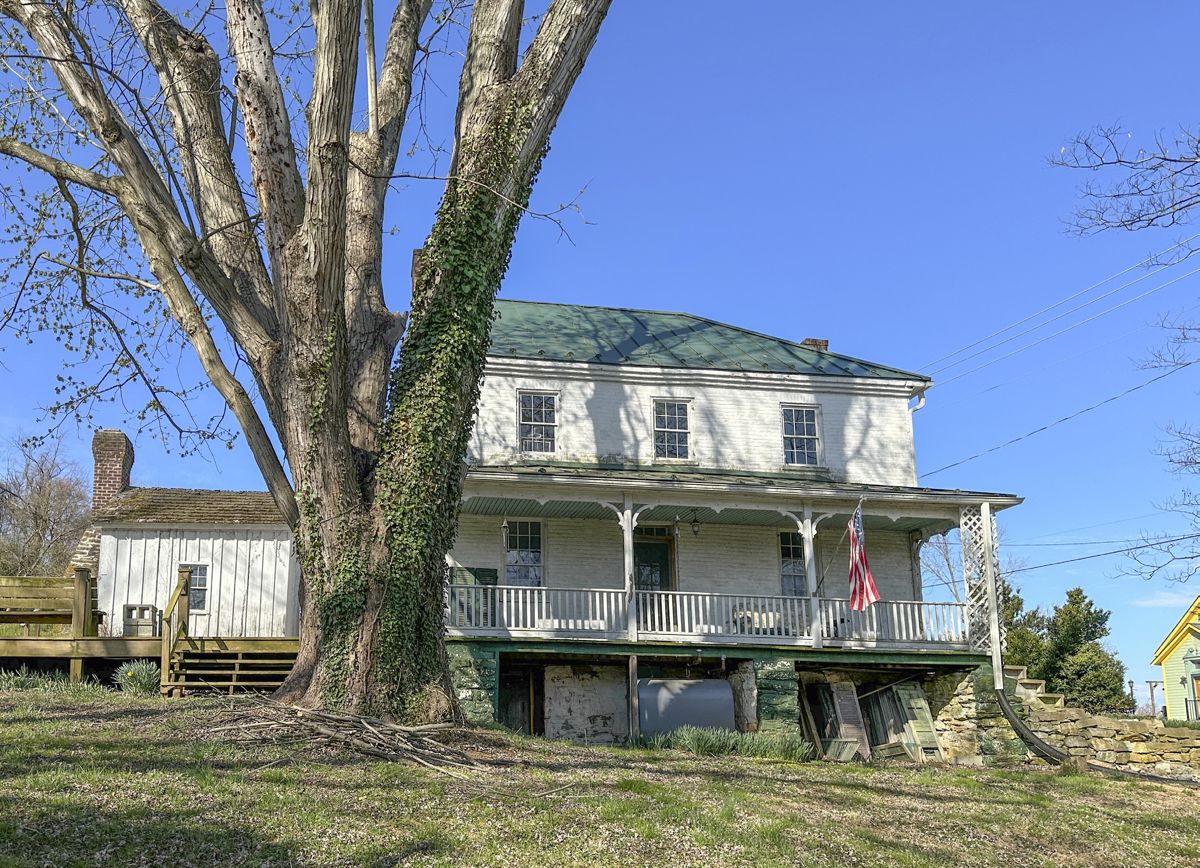
acres of hallowed ground. This battlefield land is now secured in perpetuity and encompasses key sites linked to the Maryland Campaign, most notably the Jacob Avey Farm. The historic Avey farmhouse served as the residence of the Avey family during the Battle of Antietam on September 17, 1862. The house bore witness to intense combat, with Union shells penetrating its walls. Like many civilians of that era, Jacob Avey Sr. suffered substantial financial hardships due to the battle. Despite providing food and shelter to Union soldiers in his home, Avey’s plea for reimbursement from the Federal government was denied. Additionally, the Trust announced victory on six additional acres at Antietam that were originally part of the historic Reel Farm. This preservation effort was a crucial step in the Trust’s efforts to unite substantial portions of the Antietam battlefield that had been previously saved. In the wake of the Battle of Antietam, as Confederate forces retreated across the Potomac River and into Virginia, Shepherdstown became the stage for further fighting on September 19-20. Here, the Trust’s victory extends to 122 acres of battlefield land tied to the Battle of Shepherdstown, which includes the historic Osbourn House. The majority of these acres have been largely preserved in their wartime state, serving as an invaluable resource for future generations.