1861 Redoubt Preserved on George Mason University Campus in Fairfax, Va.
By Carl L. Sell Jr. · Originally published April 2023 · pp. 8–9
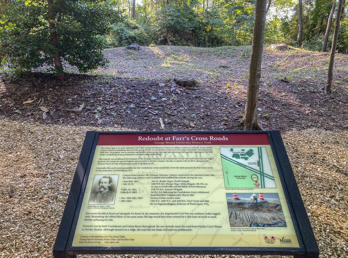
1861 Redoubt Preserved on George Mason University Campus in Fairfax, Va. by Carl L. Sell Jr. Preservation has been completed and the Farr’s Crossroads Civil War Redoubt now can be visited at George Mason University’s main campus in Fairfax, Va. The University and the Bull Run Civil War Round Table are continuing research to uncover even more nearby history. What has been learned so far is impressive. Included are interpretative markers developed by the Roundtable and the University. The Farr’s Crossroads Redoubt was built by Confederate troops in June 1861, a month before the War’s first major land battle along Bull Run near Manassas Junction. Union troops passed the site on the way to and from Manassas, with Confederates again occupying the redoubt after the battle and remaining there until March 1862. It was in Union hands for the rest of the war. A dedication program to celebrate preservation of the redoubt, along with a tour of the site, was held in October 2022. The project began in 2015 when the Bull Run Round Table contacted George Mason’s History Department and began conducting on-site classes about the redoubt’s history as part of the University’s Civil War history course. The Round Table then joined forces to preserve the site. Fairfax County’s inventory of Civil War sites, published in
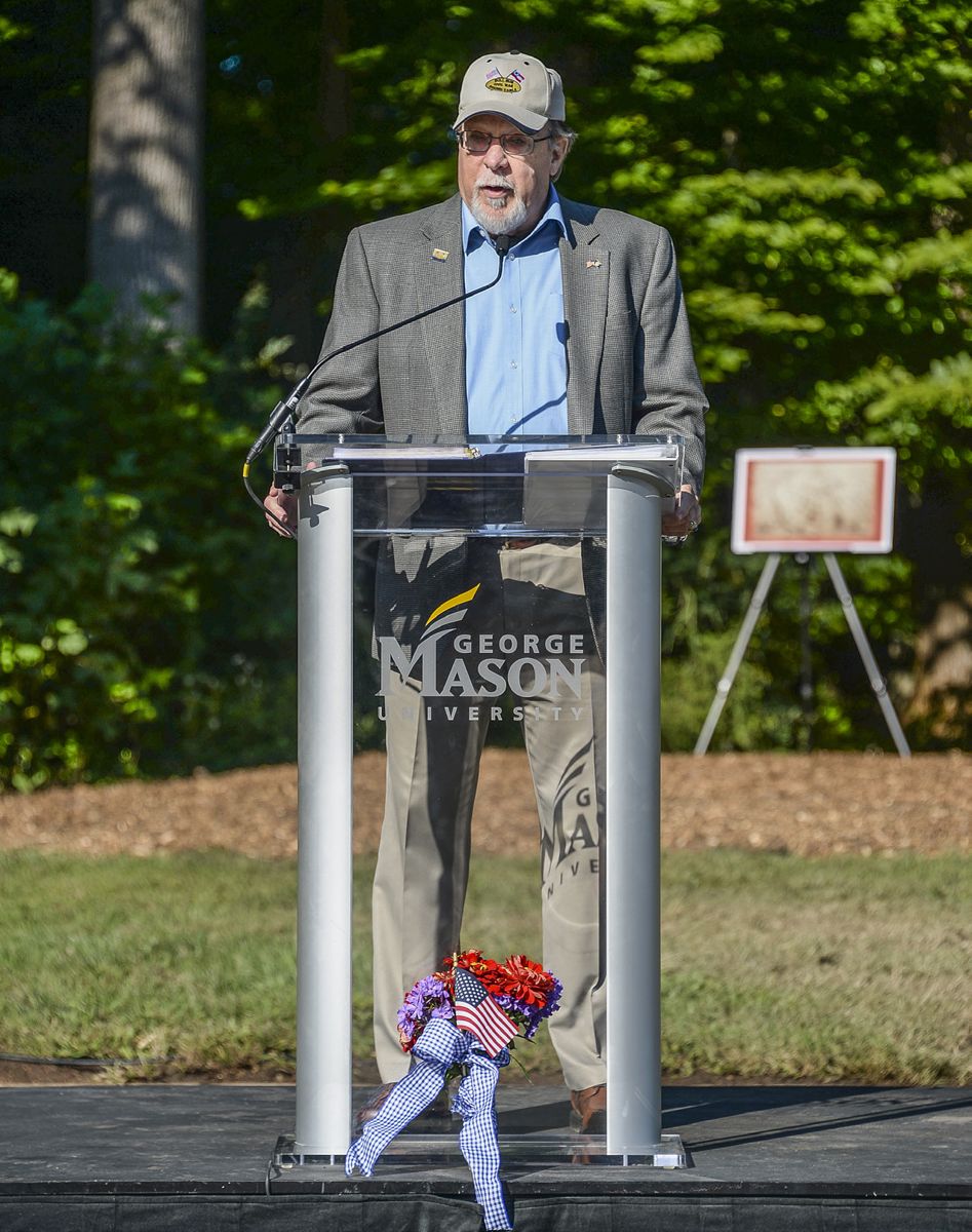
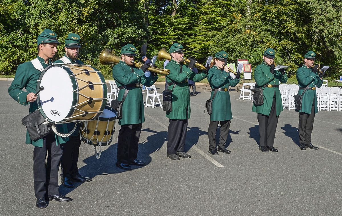
2002, documented the existence of the redoubt, other earthworks, and camps on the GMU campus. The redoubt is the last Civil War earthwork remaining on campus and is in remarkably good condition. Although in plain sight on farmland in the 1860s, the redoubt now is hidden from the junction of two major roads just steps away. Ox Road and Braddock Road, both four-lane commuter routes, now intersect at what once was known as Farr’s Crossroads. The dedication program included remarks by Blake Myers, Jim Lewis, and Brian McEnany of the Bull Run Civil War Round Table and Dr. Brian Platt of George Mason’s History Department. Music for the occasion was provided by the 8th Green Machine Regimental Band, a brass band with snare drummer, whose focus is Civil War-era arrangements. The band uses original or reproduction period instruments. Although unreachable directly from nearby roads, the redoubt is accessible through the University’s Parking Lot K in the southeast corner of the campus via Braddock Road. An historical marker with interpretative panels is located at the western edge of the parking lot. This marker’s front panel describes the history of Farr’s Crossroads, the two historic roadways, and the site’s significance during the War. On the back is information about Civil War fortifications near the site. At the redoubt, a second marker provides information about the redoubt and a nearby “corduroy road” discovered along Ox Road in 2014 and 2015. The redoubt is described as being 80 feet in diameter with a parapet height today that ranges from two to three feet, the original height being reduced due to erosion. A redoubt is an enclosed fortification without bastions, designed for visibility in all directions. The parapet walls are typically five feet or higher, and usually measured from the bottom of the fort’s ditch. The redoubt was built and occupied by the Fifth Alabama Infantry under the command of then Colonel Robert Rodes. After the Confederates fell back to defensive emplacements along Bull Run, the Sixteenth New York Infantry briefly occupied the redoubt. Following their defeat on July 21, 1861, retreating Federals streamed back to the defenses of Washington and Confederates returned to the area in the following weeks. The Twenty-Seventh Virginia Infantry, part of Jackson’s Stonewall Brigade, occupied the redoubt during September 1861. Jackson’s Brigade was headquartered at Fairfax Court House and he was promoted to Major General during that time. He and his brigade had earned the sobriquet “Stonewall” at Manassas. After the Confederate army withdrew from Northern Virginia, the First New Jersey Infantry took over the redoubt on March 9. It remained in Union hands as part of the Washington defenses for the remainder of the War. Confederate cavalry under Major General James Ewell Brown Stuart passed nearby in June 1863 on the way to Gettysburg. An archaeological assessment by George Mason graduate Brian Corle in 2008 laid the groundwork for the preservation effort. His assessment was confirmed by archeological data maintained by Fairfax County and the Fairfax County Park Authority. The historic site was part of a 283-acre farm owned by Samuel Ratcliffe Farr. On his death in 1819, one of his three sons, Richard Ratcliffe Farr, inherited roughly 183 acres, including the crossroads, which began to appear on Fairfax County maps as Farr’s Crossroads in 1879. The house burned during the war, but
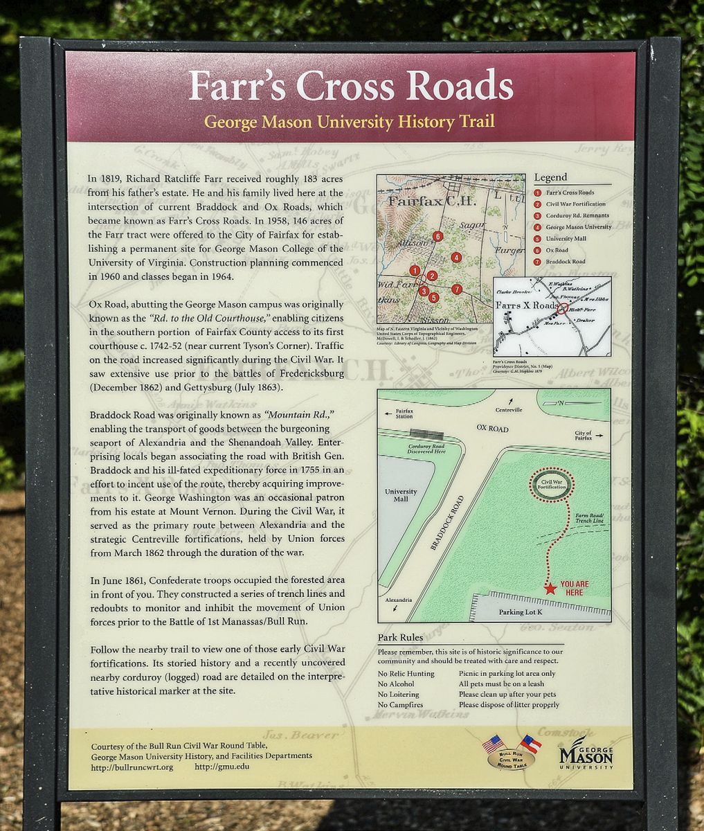
Location of the redoubt site on the George Mason University Campus.
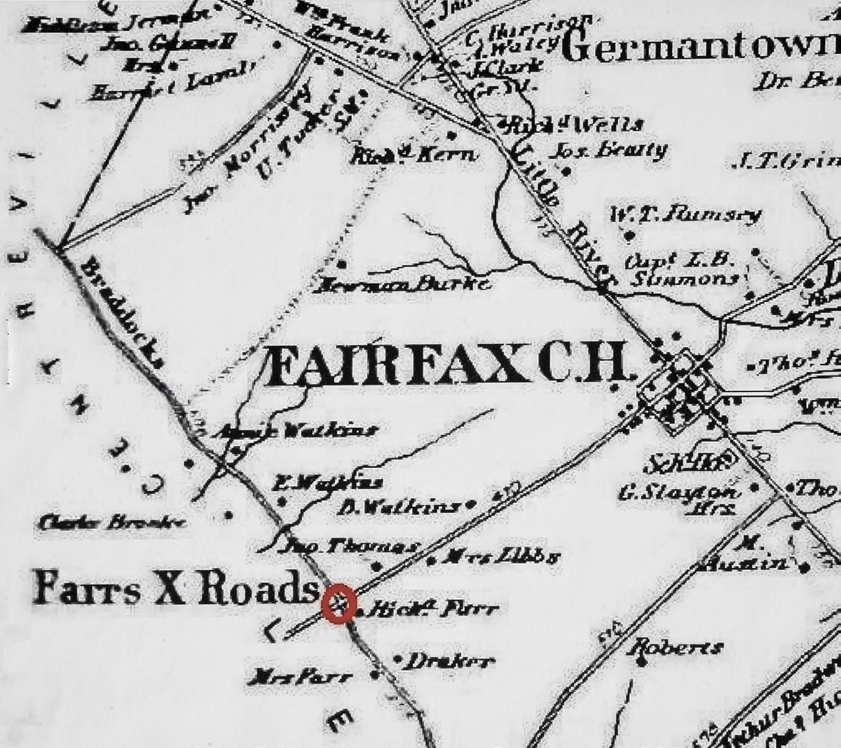
Farr’s Crossroads history signage was replaced by Richard Ratcliffe Farr Jr. Included as part of the new construction was a cottage called “Grandma’s Cottage,” which later was moved to the Historic Blenheim and Civil War Interpretative Center on Old Lee Highway in the City of Fairfax. The cottage had been built by Richard Ratcliffe Farr Jr. for his widowed mother. In (BRCWRT)
CivilWarNews.com 1958, Wilson Farr and Viola Orr, the widow of Wilson’s bother, Richard (she had married William Orr) sold the remaining 146-acre tract to the then Town of Fairfax for $300,000. The town in turn offered it to the University of Virginia Board of Regents as a site for George Mason College, predecessor of George Mason University. The roads that make up Farr’s
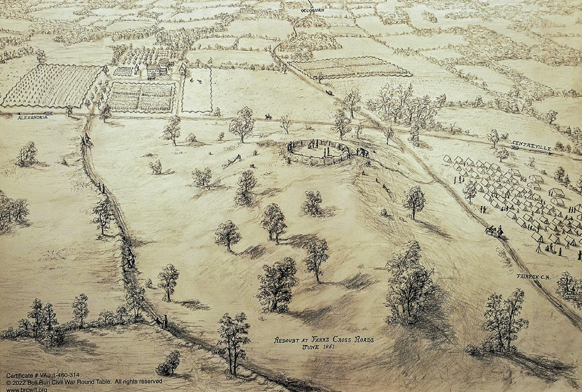
Crossroads, Ox Road and Braddock Road, have interesting histories of their own. Today’s Ox Road (Route #123) was a spur off the original Ox Road built in the late 1720s by Robert “King” Carter to connect the town of Floris (now Herndon) with Occoquan on the Occoquan River near where it meets the Potomac River. It first was called the road to the court house, which was located near today’s Tyson’s Corner before moving to its present location after Fairfax County was incorporated in 1742. Braddock Road had its beginnings as the 1720s Mountain Road, a route from the port at Alexandria west through the Blue Ridge Mountains toward the fertile Shenandoah Valley. General Braddock arrived in America in 1755 and led an expedition westward to secure the frontier against the French and Indians. His route paralleled current Route #7 to Leesburg but never did travel the road that bears his name outside Alexandria. Carl Sell is a frequent contributor to the Civil War News. Although he worked at George Mason University as Sports Information Director (retiring in 1995), Sell was unaware of the University’s Civil War history until recently. His office in the Recreation Sports Complex was cattycorner across Ox Road from the redoubt hidden by trees. Help from Genealogist Karen Conair and historians Ben Trittipoe and Blake Myers added greatly to this story. Contact Carl at [email protected] or 703-971-4716.