A Hot Fight at Cool Spring
By Carl Sell Jr. · Originally published March 2022 · pp. 20–21
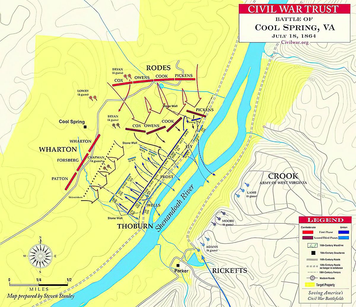
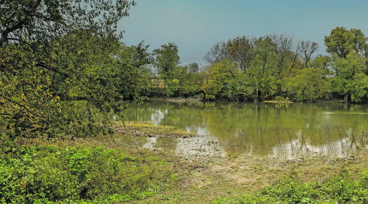
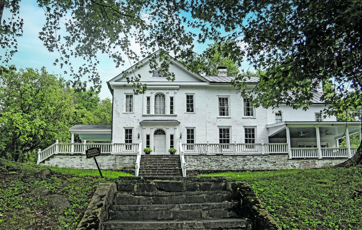
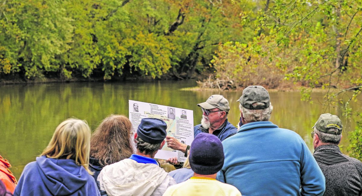
Perhaps the coolest thing about the Cool Spring Battlefield is its location. Now owned by Shenandoah University, this Civil War battlefield is located on the Shenandoah River at the foot of the Blue Ridge Mountains about two miles north of Harry Byrd Highway (Route #7) in Clarke County, Va. Most of the time, the Shenandoah moseys past the battle site with a solitude belies the bloody July 18, 1864 battle between Confederate forces led by Lieutenant General Jubal Early and pursuing Federals under the command of Major General Horatio G. Wright. Early was retreating to the Shenandoah Valley after the raid into Maryland and Pennsylvania that brought him to the doorstep of the nation’s capital. The Shenandoah University River Campus at Cool Spring is a 195-acre site that overlooks the main battlefield and once was part of the 1,120-acre estate owned by Richard Parker, the judge who presided over John Brown’s trial in 1859. Brown was tried and convicted of murder and treason and hanged in Charles Town for his attack on the Harper’s Ferry Armory. The river flows north as it heads toward Harper’s Ferry to join the Potomac for a journey to the Chesapeake Bay. The river runs north because the Shenandoah Valley and its parallel mountains rise as they head southward. The battlefield was preserved in 2012 by the Civil War Trust (now the American Battlefields Trust). Cool Spring crossing. The property was transferred to Shenandoah University in 2013 as part of a $2 million deal that included $800,000 from the Virginia Civil War Sites Preservation Fund and $200,000 from the National Park Service American Battlefield Protection program. Once the site of the Virginia National Country Club and Golf Course, the property is used by Shenandoah University as an outdoor classroom for environmental and historical studies as well as the preservation and interpretation of the battlefield. Much remains to be done, including improving the access road from Route #7. Contact Shenandoah University to see how you can help. The former golf course clubhouse is used as the headquarters for the park and includes a growing museum of artifacts and information that help explain the battle. Judge Parker’s estate house, named The Retreat, overlooks the Shenandoah at precisely the point where the battle occurred. Now used as a venue for weddings, conferences, and meetings, it is privately owned and not available to the public visiting the battlefield. However, a public trail takes history buffs from the parking lot to the river. Historic signage along the way explains the battle. The Retreat was built in 1799 by Judge Parker’s grandfather, Thomas Parker, who fought in the Revolutionary War and the War of 1812. Judge Parker served briefly in the United States Congress until he was elected judge of the Thirteenth Circuit Court of Virginia in 1859. He lived in Winchester and used the Retreat as a summer home. The Cool Spring house was built in 1794 by Ralph Worsley IV of London. Across the river is the Holy Cross Abbey, where Cisterian monks prepare their worldfamous bread and fruit cakes for sale at the gift shop. The monks have been there only since the 1950s. Enjoy the spectacular view of the Blue Ridge Mountains while you are there. The Both Sides Civil War tour has visited both sides of the river, the most recent occurring in late 2021 to view the improvements and updates accomplished by Shenandoah University. The nearby area is rich in both American history, including houses still standing that were owned by George Washington’s relatives. Snickers Gap in the Blue Ridge and Castleman’s Ferry over the Shenandoah River were on one of the most-used routes during the Civil War. Union cavalry caught up with Early’s forces at Purcellville on the road to Snickers Gap, destroying a number of wagons before being stopped by Confederate infantry. The Rebels moved through the Blue Ridge and crossed the Shenandoah River before bivouacking on the the Confederates continued their march into the Valley and the bulk of Union forces withdrew toward Washington City. Crook and his command were left to defend Winchester against Confederate capture. A week after Cool Spring, Early defeated Crook at the Second Battle of Kernstown, forcing the Union’s evacuation of Winchester. In response, Lieutenant General Ulysses Grant named Major General Philip Sheridan commander of a new Army of the Shenandoah and gave him orders to defeat Early and deny the Confederates their most fertile area of supplies. Starting with the Third Battle of Winchester, Sheridan rolled up a series of victories that seized control of the Valley by causing Early to retreat all the way to Staunton and beyond. What followed was the destruction of crops, stores, and animals that otherwise would have been sent to General Robert E. Lee’s army at Petersburg. Today, there are few, if any, outbuildings and barns dating before 1865 in the Valley between Winchester and Lexington. Carl Sell is a co-leader of the Both Sides Tours as well as an author and frequent contributor to CWN. He has written books about his great grandfather, James Farthing, in the Civil War as well as a recent update on the life or Major General James Ewell Brown Stuart. Ironically, Carl also has published a booklet about Civil War activities in the area of Snickers Gap, the break in the Blue Ridge that overlooks the Shenandoah River and the Cool Spring battlefield. The Gap was one of the main avenues of movement by both sides during the war. Contact Carl at sellcarl@ aol.com of 703-971-4716. Berryville Turnpike. Early on July 18, cavalry led by Union Brigadier General Alfred Duffie attempted to cross the river at Castleman’s Ferry but was beaten back by Confederate artillery and sharpshooters under Major General John B. Gordon who were stationed in houses so they were literally looking down at their adversaries. Almost two years earlier, the same thing happened when Union cavalry attacked Confederate forces under Major General A. P. Hill who were resting there after battles at Antietam and Shepherdstown. As a result, Brigadier General George Crook and Wright agreed to try an attack downstream. Led by Confederate deserter John Carrigan, a harness maker who lived in the area, Colonel John Thoburn took approximately 5,000 men, who were shielded by trees along the river, and began to cross at Parker’s Ford in front of The Retreat. They captured a number of Confederate skirmishers, who reported large numbers of their comrades camped nearby. Nonetheless, Thoburn advanced and set up a line behind a stone wall about 75 yards from the river. From their vantage point on the mountain, Generals Crook and Wright could see the Confederates moving toward Thoburn’s position, including a contingent led by General Robert Rodes that threatened the Union right flank. Many Union defenders were forced back across the river, but others held their ground and were able to fend off three charges by Rodes before retiring at nightfall. Federal artillery helped slow the Confederates, but shells occasionally landed on the defenders, adding to the casualties. Although of short duration, Cool Spring was a particularly bloody affair, much like many clashes in the Shenandoah Valley. Union losses totaled 422, including a number who drowned while trying to cross the river to safety. Confederate losses were 397. At the height of the battle, Brigadier General James Ricketts refused to move his men across the river to support Thoburn despite Brigadier General George Crook’s request to do so. Crook then appealed to Major General Wright, who agreed with Ricketts, citing the strength of the Confederate position. After a day of sporadic gunfire on both sides,