
National Register Battlefield Threatened by North Carolina Highway Interchange
Originally published June 2022 · pp. 1–9
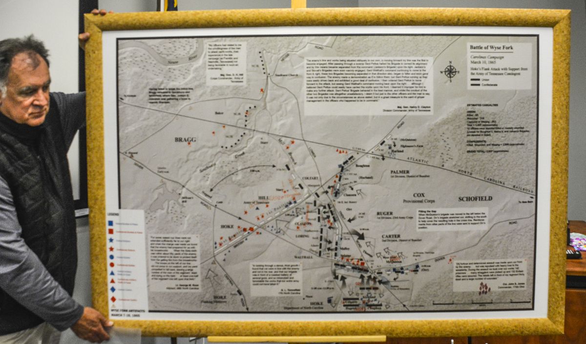
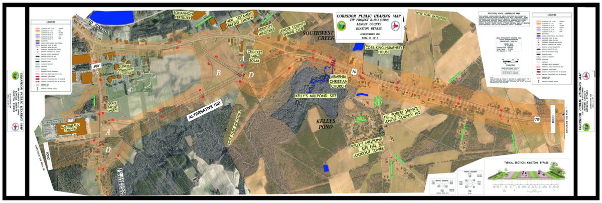
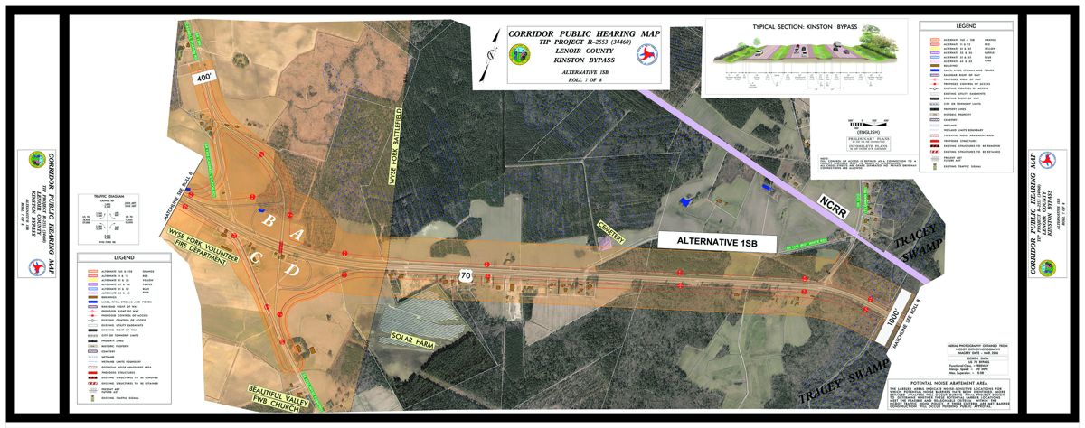
KINSTON, N.C.—The Wyse Fork Battlefield, Kinston, N.C., some 4,000 acres of historically significant landscape is now threatened by a proposed construction project (TIP Project R-2553 (34460) for a new interstate (I-42) that will run from Raleigh to Morehead City. The planned North Carolina Department of Transportation (NCDOT) I-42 bypass includes an intersection that will destroy the core battlefield area as defined in the National Register. The Wyse Fork Battlefield National Register District (NRD) application was submitted to the NC State Historic Preservation Office and filed as a NRD in 2015, federally designated as a NRD in 2017, and specifically honors North Carolina’s third largest Civil War land engagement; it has several other historical and legally protected entities as well. In specifics, it would eliminate or relocate the historic Cobb House, the Union headquarters and field hospital, as well as the entire left flank of Maj. Gen. Jacob D. Cox’s defensive line, the original intersection over which the armies fought, a 1781 Revolutionary War component, and portions of two other 1864 engagements within the NRD. There are also historically significant buildings and family graveyards. The existence of mass burials associated with the 1865 battle can be projected, based on the number of casualties, Union officer accounts, and current practices of interring those killed in action. The Wyse Fork road junction is located on higher ground bordered several watercourses. The high ground is virtually surrounded by wetlands that dictated where the historical pathways that became roads traversed the landscape. The cross roads is part of a road network that minimized lower, swampy ground and provided
Proposed route laid over Wyse Fork Battlefield National Register Core Area. a solid surface for foot, horse, and wagon traffic in the past, just as it does for today’s motorized vehicles. Right-ofway acquisition is slated for 2023 so the final decision on impacting Wyse Fork has not yet been made. On April 30, 2022, some 50 people, chiefly from eastern North Carolina, but others from as far away as Oregon, toured Wyse Fork NRD with specific attention paid to those areas most likely to be impacted by the project. Among the tour
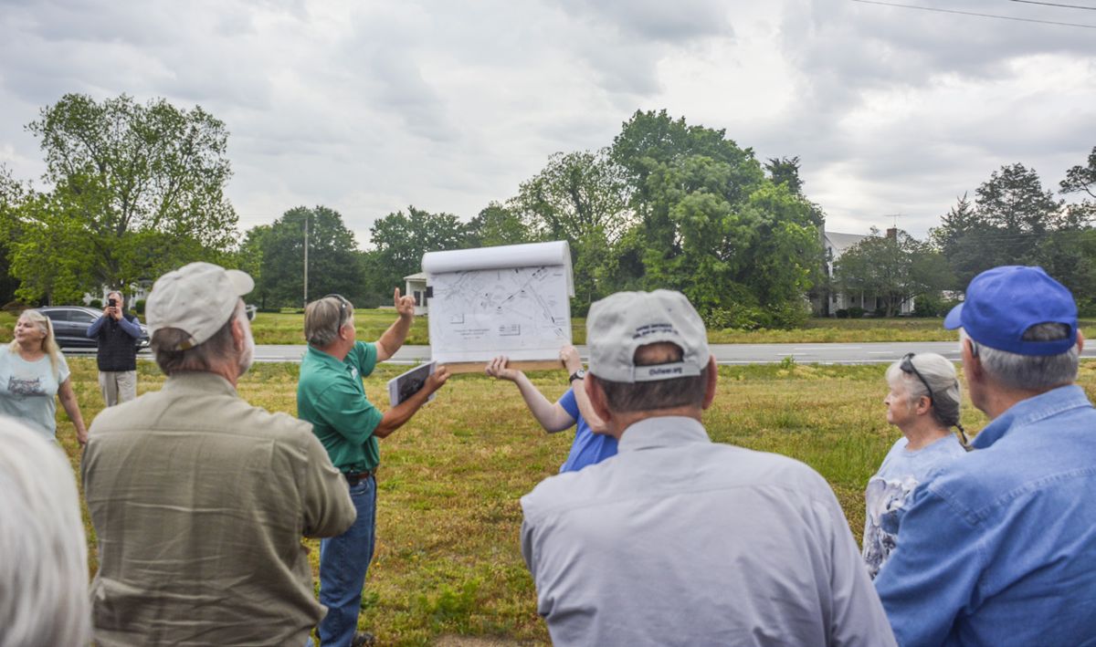
NC House of Representative Chris Humphrey and Karen Nethercutt, descendant of Colonel John Nethercutt.
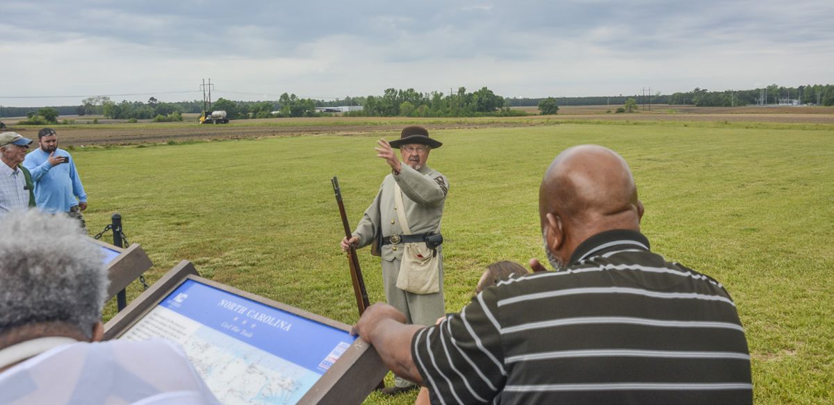
group were several descendants of soldiers who fought at Wyse Fork, including Karen Nethercutt, a descendant of Colonel John Nethercutt, 66th North Carolina Infantry, who also served on General Hoke’s staff and rode through intense artillery and musketry almost into the Union entrenchments on March 10, 1865. From current landowners and other local residents, it was apparent that oral traditions about the battle are still common and relate to places, people, and specific events that are incompletely recorded. At the road junction the tour group was treated to a living history presentation by Wilbur King, who portrayed his great great grandfather Sgt. John Parker Miller, Company H, 66th NC Infantry, who fought in the field just south of Dover Road/I-70 at Wyse Fork. He survived but was killed shortly after the war. Chris Humphrey, NC State Representative for Lenoir and Greene Counties, came along on the tour, representing Lenoir and in the summer of 2021, whilst collecting artifacts relating to the 1865 battle, local metal detectorists identified two linear distributions of round lead balls and other 1781-era artifacts within the National Register District. The linear distribution of the artifacts indicated a military event. The two round ball sizes (ca. .72 and .634-645 inch) reflected standard bullets larger than Civil War sizes for the caliber .75 British Brown Bess (at least 10) as well as the .69-inch French muskets (117 Map detail showing linear distribution of probable bullets) arming Patriot militia Revolutionary War bullets just above Kirkland attack and Continental troops after arrow. 1779. The total number of bullets, Greene Counties. He was very and Captain John Gordon’s NC plus buckshot used in buck and interested in the battle and the Independent Dragoons. Several ball rounds by both sides, and story of preserving the hallowed skirmishes ensued; largely hit associated artifacts including ground. “I think we’re getting and run raids conducted by local coins, made it possible to attribute their attention,” he said, referring militiamen who could not engage their presence to the fight against to local efforts to ensure the in a long fight because they Craid’s Punitive Expedition. battlefield survives as heritage were short of ammunition. Two A caveat should be noted here. tourism is a major revenue source skirmishes, on August 16, 1781, The weaponry of both Union for Kinston and Lenoir County. and August 21, occurred within and Confederate regiments is Mr. Humphrey recommended the boundaries of the Wyse Fork known; most Civil War infantry continuing to send letters to NRD when approximately 150 used elongated rifle bullets of the North Carolina DOT about Carolina militiamen tried to the Minié types in calibers .58, preserving the battlefield by stop Craig but were scattered by .577, and .54. Probable Civil War altering the right-of-way. Craig’s Provincial dragoons. The round projectiles from Wyse Fork number of casualties is unknown also include some round balls but but probably low; Craig turned these are much less pitted than 1781 east, fought his way into New Bern the probable Revolutionary War In the earlier fighting at Wyse and occupied the town for two examples found at Wyse Fork. Fork, British soldiers battered days. Then the British returned More, less pitted round balls local militiamen, Major James to Wilmington, fighting another also came from other areas of Craig, 82nd Regiment of Foot, skirmish at Wyse’s Fork. At least the Wyse Fork NRD and may was commandant of the British one, if not both, engagements indicate Confederate use. forces occupying Wilmington, fall well within the core National N.C. During the late summer Register District where heavy 1865 – The Battle of 1781 Craig announced forfeiture 1865 fighting also occurred close Wyse Fork of all property belonging to to the road junction. The general anyone who did not swear linear orientation of two 18th There were at least two Civil allegiance to King George III. He century bullet distributions is War engagements at Wyse Fork included prison and/or execution perpendicular to, and along, the prior to the better known 1865 as penalties to encourage British Road approaching Wyse battle. Both 1864 fights occurred Patriots to reclaim their British Fork from the south. The name in the NRD Core Area, as the citizenship. At the end of July, of the road traditionally derives combat ranged from the road Craig left Wilmington heading from British Army use during the junction west to Southwest for New Bern with his 82nd Revolution. Creek. Most of this skirmish Foot, a detachment of artillery, During the 1970’s, and again was centered on the Dover
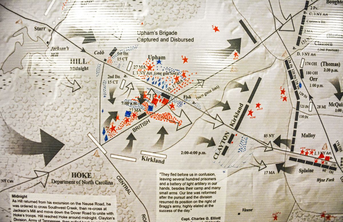
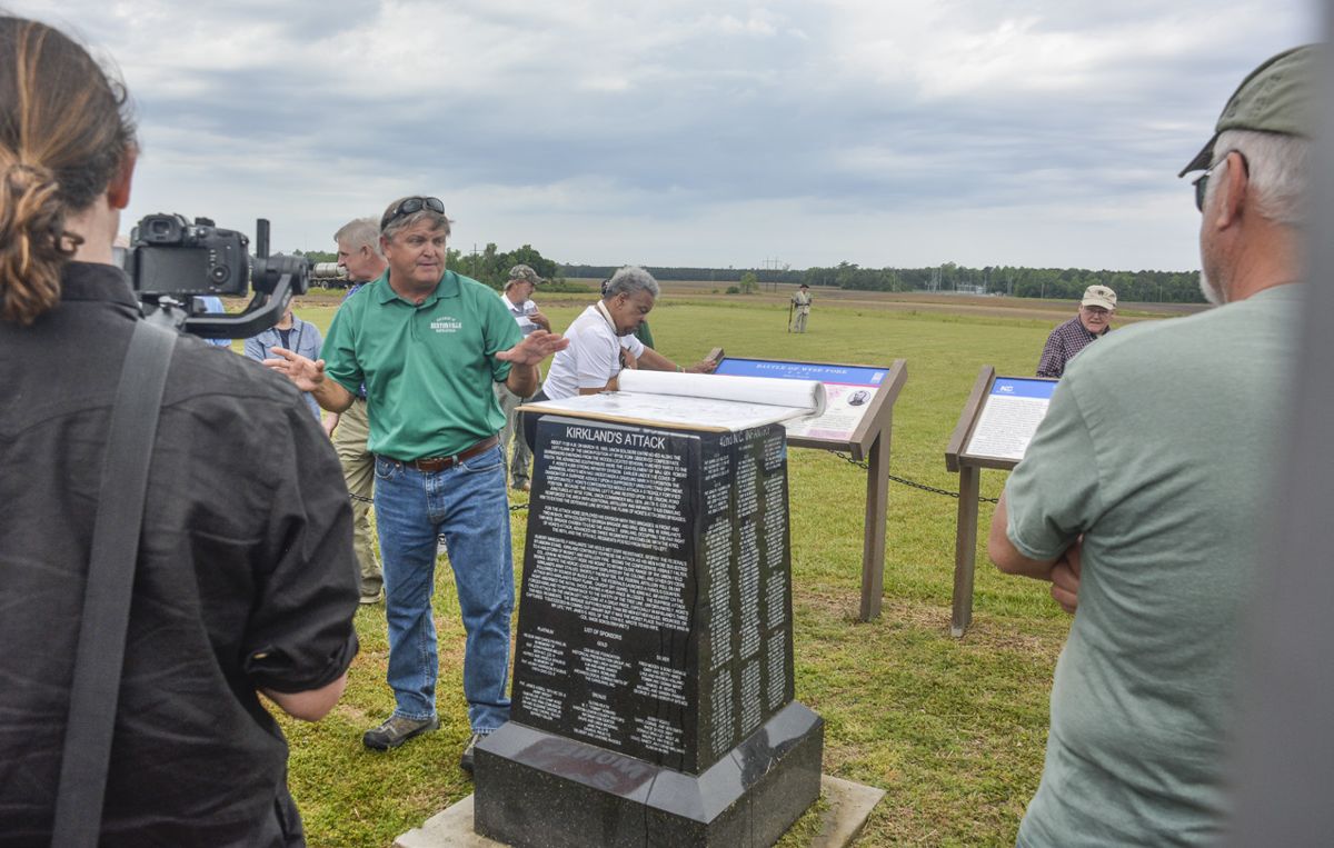
Wade Sokolosky discussing Confederate attack. Road (modern Route 70) but it expanded around Kelly’s (in 1864, Jackson’s) Mill Pond where a bridge crossed Southwest Creek. The battlefield’s core area was specifically defined to include the mill and strong Confederate entrenchments that guarded the stream crossing and extended to the nearby Neuse River. Briefly, the last and largest Wyse Fork engagement took place from March 8-10, 1865. It was an attempt by the Confederates to stop a Union force coming from New Bern to reinforce Sherman’s two armies marching into North Carolina. While often seen as a prelude to the even larger March 19-21 Battle of Bentonville, the fighting at Wyse Fork stands on its own as one of the last Confederate offensive efforts. On March 8, 1865, General Robert F. Hoke’s Confederate Division conducted a flank attack that destroyed a Union brigade and captured over 800 Yankees just west of Wyse Fork. March 9 was spent probing for weak spots in the Union defensive line anchored at Wyse Fork; the Southern attacks were foiled by Federal infantrymen moving on shorter, internal routes behind their main battleline. On March 10, Hoke attacked again, this time against Union forces aligned along the Dover Road at Wyse Fork. The Federals numbered two well dug in divisions supported by a dozen cannon. As the Confederates closed in on their defenses, unengaged Union troops advanced against Hoke’s right flank and opened a devastating fire into the 42nd North Carolina that helped cause the attack’s failure. Simultaneous attacks against other parts of the Union position were thwarted by rapidly shifting temporarily unengaged troops to threatened areas where they held off the assaults. The Confederate forces were withdrawn across the Neuse
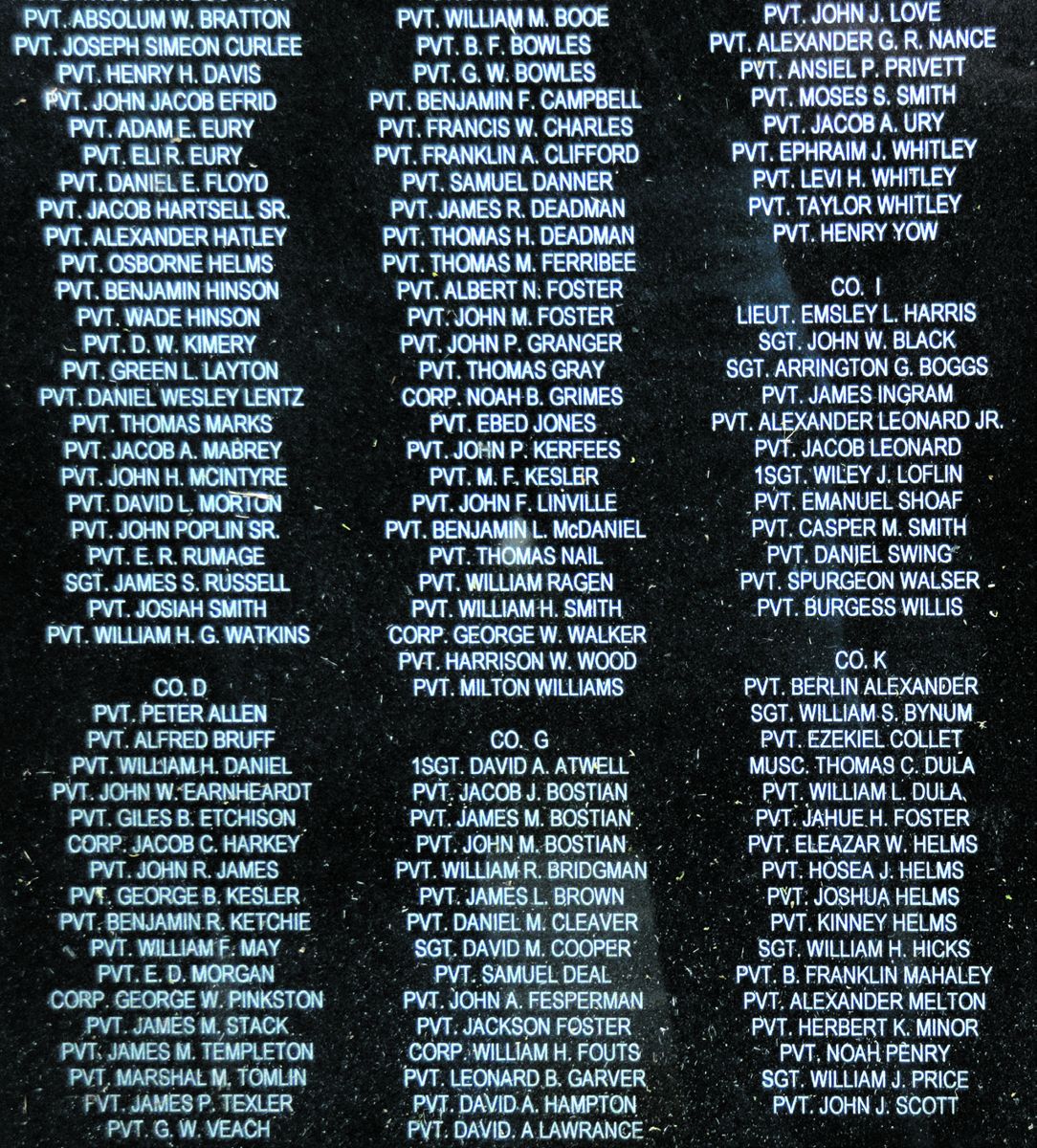
River overnight. In the March 10 attack against the well dug in Yankees, the 42nd North Carolina lost a musician who became very famous during the late 1950’s. His name was Thomas Dula. In the Kingston Trio’s best-selling ballad about the soldier, they called him Tom Dooley. There are many similar, but too numerous to include here, stories about less famous participants in the fight.
Wyse Fork Battlefield core and study areas map.
1865 Burial Sites (Mass Graves) Casualty totals for the two sides are difficult to reconcile. Information suggests there were about 4,000 casualties of all sorts including prisoners of war. Captain J. Madison Drake, 9th New Jersey Infantry, reported that his regiment buried over 800 Confederates and 71 Federals. Regimental histories do not mention where these bodies were interred, but they noted the Confederates made seven attacks on March 9, and eleven on March 10. On March 11, the dead were buried in trenches dug in close proximity to the various clusters of the fallen; most were between the Lower Trent and Central roads, from the railroad south to beyond Wyse Fork. A mass grave is postulated immediately southwest of the present Wyse Fork intersection. Both areas saw heavy fighting during the battle and other unreported graves must be presumed to exist in front of the Union positions.
The Native American Military Presence An ironic aspect to the Wyse Fork NRD’s historical component is that Tuscarora Indians, a tribal group ancestral to North Carolina fought within the NRD on at least three occasions. Following their defeat in the 1711 Tuscarora War, the tribe migrated north and became the sixth nation in the Iroquois Confederacy. Company D, 132nd New York Infantry, was recruited during the spring and early summer of 1862. Lt. Cornelius C. Cusick successfully recruited over two dozen Native Americans for the company; including Isaac Newton Parker, a Seneca, whose brother Ely ended the war as a brigadier general on Ulysses Grant’s staff. Often called the “Tuscarora Company,” the unit had naturalized and native born Americans of European ancestry as well. In late December 1862, the 132nd NY Infantry was ordered to New Bern, N.C., the same area their ancestors had occupied until 1711. The regiment performed a variety of duties, including manning outposts around New Bern and participating in patrols. Their first mission into the interior saw them as part of an 1864 exploratory raid on Kinston. Company D’s part took them to Jackson’s Mills, less than two miles west of Wyse Forks and within the NRD core area. On June 21, 1864, the
Tuscarora Company attacked and took the Confederate outpost at Jackson’s Mills, manned the entrenchments, then started intercepting messengers traveling to and from Kinston. Among their prisoners was Colonel Nathaniel Folks, 65th NC Infantry. In the meantime, another Union element attacked Wyse Fork and drove that outpost toward Kinston and the Tuscarora Company blocking their way. They started capturing the fleeing Yankees, one of whom paraphrased a line later used in Clint Eastwood’s movie, The Outlaw Josie Wales, by saying “No one but a Yankee could play me such a clever trick as that.” Eventually three 132nd New York companies captured five officers, 51 enlisted men, and a wagon train, plus killed or wounded another 20. When Kinston was seen as too strong a position, the expedition returned to the New Bern area June 23. The Tuscarora Company returned in December 1864 and skirmished along the Dover Road from Wyse Fork to Jackson Mills. The 132nd returned in March 1865 and were engaged in skirmishing on March 6; on March 7, they got into a hot skirmish at Jackson’s Mill Pond where they had fought the summer before. As Union units were shifted around, the Tuscarora Company was positioned in various places in the Federal defensive line, where they held off desperate Confederate attacks. The Iroquois infantrymen in 132nd New York were fighting on their ancestral land against the descendants of those who had forced them to leave over 150 years earlier. Wyse Fork was their last battle and they held firm, having fought, this time successfully, on ancestral tribal land.
The I-42 interchange Of multiple known proposals for the highway, most were situated well away from the Wyse Fork battlefield; however the currently planned route and its interchange entrances and exits affect the core battlefield area as well adjacent wetlands requiring permitting action from federal agencies other than the National Register. Lack of federal funding would tend to negate any federal requirements for considering cultural resources, which seems to be precisely why NCDOT is not using Federal money. In turn that means that North Carolina citizens will pay for the destruction of their common heritage with little more than lip service being paid to avoid damage. A March 23, 2022, statement by a NCDOT spokesperson states that the entire
CivilWarNews.com project is state funded (Heather Lane, Contact US NCDOT). That statement is not accurate as the entire project is federally funded EXCEPT the Wyse Fork interchange. While federal funding requires mitigation of adverse impacts under numerous cultural resource preservation laws, the project also requires federal approval from agencies overseeing environmental considerations prior to construction. Before those agencies can issue their approval, mitigation of adverse impact to cultural resources must be undertaken under the provisions of Executive Order 11593, Archaeological Resources Protection Act (ARPA) and National Environmental Policy Act (NEPA). Thus, if the I-42 interchange affects the Wyse Fork NRD, and requires approval from federal agencies, including the U.S. Army Corps of Engineers, even if not federally funded, Section 106 requirements about cultural resources (the battle’s artifactia legacy) must be met. This requirement is true for any stretch of I-42 requiring permitting actions whether it is federally or state funded. North Carolina was applying these same laws as early as 1975 under the aegis of the A-95 Review Process run through the Department of Cultural Resources. As a caveat to how serious the NC DOT danger to Wyse Fork National Register District is, one example should suffice. NC DOT constructed a bypass (I840) around northern Greensboro within the last four years. In complying with Federal cultural legislation, the DOT contracted with a competent, experienced professional archaeologist to conduct a cultural resources survey but apparently stipulated that the survey be conducted using test pits at certain intervals. The survey found no 18th century artifacts despite being immediately north of the central axis of the 1781 Battle of Guilford Courthouse NRD and immediately south of a grave site that contained bodies of three Continental soldiers killed on March 15, 1781. The rightof-way zone between the NPS border and the grave obviously should have been considered as a battlefield and surveyed using appropriate methods, including metal detecting along transects spaced less than eight feet apart across the entire area. Between the Guilford Courthouse National Register property and the grave site, over 1,000 battle related artifacts were recovered by metal detectorists who made their collections available to archaeologists in 2018. Between the artifacts and sworn pension applications filed by battle participants, it was possible to partially reconstruct how Delaware and Virginia soldiers held off a British attempt to outflank, and then cut off the Continental Army’s retreat. While NC DOT observed the specifics of the law, they utilized outdated methodology and found nothing, then proceeded to grade the North Flank fighting area, followed by paving, before opening the roadway for traffic ca 2021. As stated in several reports, “Shovel testing at maximum 50 foot intervals proved useless … the systematic metal detecting revealed the military occupation” (Geier et l 2016:18). While Geier’s work was at a camp; a much shorter term, larger, and linear battlefield is even less likely to be found using test pits. The example is only one of many, ranging from the unintended consequence of removing a marl bed in front of Fort Fisher, permitting the fort’s sea face destruction by the next hurricane, to the I-85 Yadkin River crossing where known sites were simply ignored. It would be a disaster for ever understanding details of what happened in 1865 and 1781 if any such ground alteration were to occur at Wyse Fork without a detailed archaeological study using now accepted methods to recover information. While wetlands and forests can be restored, an archaeological site can never be regenerated; once it is gone, it is lost forever. This is not a red line, or a line in the sand, that line was established with the National Register nomination. An addendum to the NC DOT published plans should include the borrow pits required for building the ramps and overpasses. Obtaining fill dirt would add as much as another 40-60 percent of the total area disturbed by the interchange. One stated position about the borrow pits is that folks are “not allowed to speculate on this.” If that quote is an accurate portrayal of NC DOT’s transparency and callousness, the National Register Battlefield is truly in great danger. References Cited Anonymous n.d. Battle of Wise’s Fork March 8-10, 1865. Bradley, Mark L. 1996 The Battle of Bentonville. Savas Woodbury Publishers, Campbell, California. Collins, Donald 2021 The Return of the Tuscarora: Company D, 132nd New York Infantry and the Civil War in Eastern North Carolina. Civil War News 47:8:30-34 (August 2021). Edwards, Tom J., and William H. Rowland 2006 Through the Eyes of Soldiers: The Battle of Wyse Fork,
Kinston, North Carolina, March 7-10, 1865. Lenoir County Historical Association, Kinston, NC. O’Kelley, Patrick 2005 “Nothing but Blood and Slaughter” The Revolutionary War in the Carolinas. Volume III. Blue House Tavern Press, Barbeque Township, NC. Geier, Clarence, Joseph W. A. Whitehorne, and Alyson L. Wood
2016 Wesley Merritt at Cedar Creek: The Archaeological Delineation of a 1st Division Cavalry Camp, Army of the Shenandoah, October 1864. IN Preserving Fields of Conflict: Papers from the 2014 Fields of Conflict Conference and preservation Workshop, Columbia, SC. South Carolina Institute of Archaeology and Anthropology, Columbia, pp. 179-85.