
Central Virginia Battlefield Trust
Where Generations Walk (Or Drive) In Central Virginia
By Sarah Kay Bierle · Originally published June 2021 · p. 25
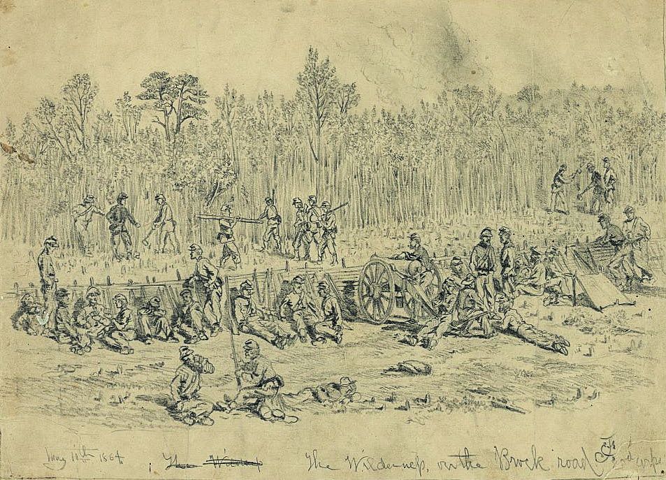
Where Generations Walk (Or Drive) In Central Virginia by Sarah Kay Bierle “One generation builds the street on which the next will walk,” reads a Chinese Proverb, reflecting on the changes passed from era to era. Many roads connecting or running through the Civil War battlefields of Fredericksburg, Chancellorsville, The Wilderness, and Spotsylvania Court House existed prior to the 1860’s and are still visible or in active use today. Both the Army of Northern Virginia and the Army of the Potomac used the Central Virginia road network during their campaigns, battles, and maneuvering. Generals on each side used maps or local guides to help them better use the roads for logistics and quicker troop movement. Good roads had particular importance through the dense second-growth forest in Spotsylvania and Orange Counties known as The Wilderness. To look a little closer at the importance of roads and their preservation, let’s take another look at Brock Road and the Federal change of supply base early in the 1864 Overland Campaign. Brock Road (now modern Road 613) meets the Plank Road west of Chancellorsville and runs southeast to Todd’s Tavern and Spotsylvania Court House, an approximately ten mile stretch. Though the roadway was used during the Colonial Era prior to the Revolutionary War, one of the first military movements along the road took place when the Marquis de Lafayette marched his troops along the route as he maneuvered through Central Virginia during early parts of the 1781 Yorktown Campaign. During the Civil War prior to the Overland Campaign, Confederates utilized the road, most notably during the 1863 Battle of Chancellorsville as General “Stonewall” Jackson’s soldiers made their Flank Attack March. Later, General Jackson was moved by ambulance along Brock Road toward Guinea Station after his wounding and brief stay in the field hospital. The 1864 Overland Campaign opened as Union Major General George G. Meade, accompanied by Lieutenant General Ulysses S. Grant, took the Army of the Potomac and the IX Corps on a strike through Central Virginia to battle Gen. Robert E. Lee’s Army of Northern Virginia. The Union army started from Culpeper, Va., and moved east. Both commanders hoped to move quickly through The Wilderness, using the few roads through the region. Instead, the Confederates launched an attack along the Orange Turnpike (modern Route 20) which started the Battle of The Wilderness on May 5. Brock Road was in near constant military use for the next two and a half weeks. The Union II Corps traversed it into The Wilderness, built trenches along the roadbed, and fought there, adding more history to the layers of the generations. On May 6, after two days of fighting, Grant decided to move the army toward Spotsylvania Court House using Brock Road. Orders and messages recorded the order of march down the historic road, the details of moving thousands of soldiers via one of the few militarily usable roads for moving in that direction. Skirmishes broke out as the Confederates slowed the Union advance near Todd’s Tavern and the rest of the way toward Spotsylvania Court House. The Confederates established defensive lines across Brock Road about 1.5 miles from the court house village. This led to another battle along Brock Road as more Union troops came down the route’s northern section into the fight. Warren’s V Corps and Sedgwick’s VI Corps lined up perpendicular to Brock Road and charged down the hard packed dirt and through bordering fields, trying to break the Confederate position. Part of the land directly bordering Brock Road where Warren readied and rallied his soldiers has been preserved by Central Virginia Battlefields Trust. During the ensuing two week battle around Spotsylvania Court House, including fighting at Po River, the assaults on the Mule Shoe Salient and Heth’s Salient, the battle at Myer’s Hill, and attacks at Harris Farm, Grant rotated his army eastward and probed for another way around the Confederates. The road between Fredericksburg and Spotsylvania Court House became more important to the Federal army than Brock Road. The shifting military lines and two-week battle around Spotsylvania Court House prompted Grant to change his supply base, illustrating the importance of the road networks during Civil War campaigns. Instead of transporting supplies over 40 miles from Culpeper, where the campaign started and the army had spent the previous winter, Grant shifted his supply base to Fredericksburg. That city along the Rappahannock River was only about ten road miles from the Union army’s position and had access to waterway and railroad lines that were keys for bringing in supplies and helping evacuate wounded to larger hospitals further north. Brock Road is certainly not the only important road in the Central Virginia area. Others, like the Orange Turnpike, Plank Road, Orange Plank Road, Cartharpin Road, and additional lesser known roads, formed a network across the campaigning area, connecting to each other and to the important river fords. Like Brock Brock Road
Brock Road is visible in this historic map. Road, they have unique histories these roads. At Central Virginia stretching back into the early eras Battlefields Trust, preserving the of history. history etched into the land is Driving along the “country important. Some saved land borroads,” observing the distanc- ders, and thereby protects, hises, noting elevations and land- toric roads, and other preserved scape changes helps historians, tracts hold no-longer-used road researchers, and interested bat- traces from the past. tlefield visitors see and underStanding on a battlefield and stand the routes the armies took understanding how the fight unand why battles unfolded the way folded is important; recognizing they did. Today, Brock Road is how units moved to their fighting a moderately busy, paved road locations is also a key for explorconnecting modern Route 3 to ing military tactics and stories of Spotsylvania Court House, run- personal courage that occurred ning along basically the same in the fields. Driving the 45 mile roadbed traversed by the Civil per hour speed limit along Brock War armies. It was already his- Road sometimes seems too fast. toric before the 1860’s, but Civil That is the place where the armies War battles that occurred on or marched, and it remains to be adjacent to this road make it a seen how land along the road and piece of hallowed ground.
“One generation builds the street” the old proverb reminds. But what happens to that street depends upon those who walk or drive it in the present and future. Just as there is a tendency to build on battlefields, there is “progress” for roads, including widening, traffic circles, and more signals. While road safety is greatly important to a community, perhaps there are also steps that can be taken to preserve and acknowledge the historic nature of these roads. At Central Virginia Battlefields Trust, preserving the history etched into the land is important. Some saved land borders, and thereby protects, historic roads, and other preserved tracts hold no-longer-used road traces from the past.
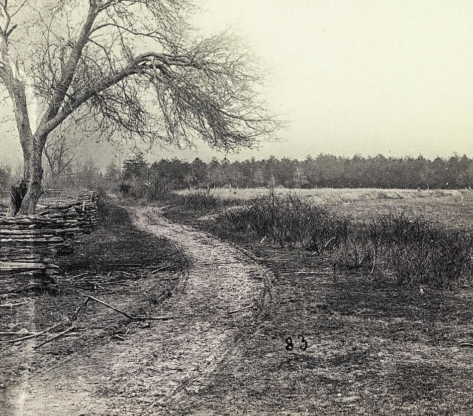
Standing on a battlefield and understanding how the fight unfolded is important; recognizing how units moved to their fighting locations is also a key for exploring military tactics and stories of personal courage that occurred in the fields. Driving the 45 mile per hour speed limit along Brock Road sometimes seems too fast. That is the place where the armies marched, and it remains to be seen how land along the road and the integrity of the historic road itself can be preserved for the next generation to walk…or drive.
Sarah Kay Bierle serves as the Chief Administrative Officer at Central Virginia Battlefields Trust. CVBT saves battleground to preserve the memory and meaning, sacrifices and stories of the men who fought at Fredericksburg, Chancellorsville, The Wilderness, and Spotsylvania Court House. Learn more: www.cvbt.org.