Electric Map Nears Completion In Hanover
By Leon Reed · Originally published May 2016 · p. 10
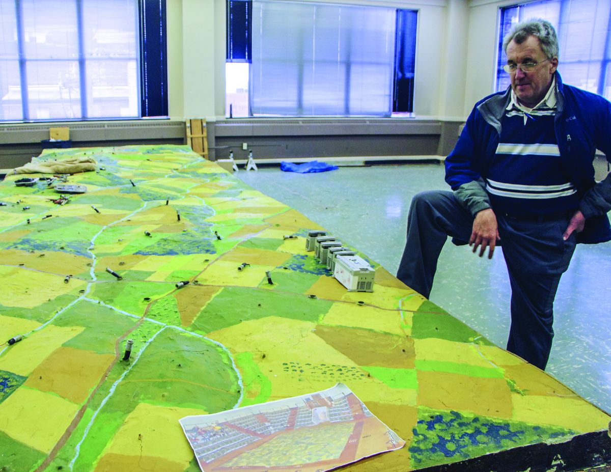
HANOVER, Pa.—For more than 50 years, a visit to the Electric Map was one of the essential first stops before a tour of Gettysburg. Within a few months, the flashing lights may once again be delighting visitors, though now they will have to travel 12 miles to nearby Hanover to see it. The first electric map was installed in the private Rosensteel Museum in the 1930s. A newer and larger map was installed in 1963. Both maps used a series of flashing lights to illustrate the battle of Gettysburg as a narrator read a script. The National Park Service took over the Rosensteel Museum in 1971 and used it as its Visitor Center until the new one opened in 2008. Despite occupying a place of honor in the old Visitor Center, the map did not make the cut to move over to the new Visitor Center, which opened in 2008. “[GNMP director at the time] Latschar hated it,” said former map operator Bernadette Loeffel-Atkins. “Latschar called it the ‘Electric Nap.’” The last Electric Map show was on April 13, 2008. Scott Roland bought the 12-ton map for $14,000 at auction in 2012. He hopes to open it as an attraction at a conference center in downtown Hanover. “All I got was the map,” said Roland. “The control panels were gone, the wiring was shot, and there wasn’t even a script or a wiring diagram. We even had to figure out which segment represented which part of the battle to know how to reassemble the map.” Over the past three years, he and his team have removed asbestos and rewired and relit the entire map – a total of more than 800 bulbs and seven miles of wire. “The wiring was a nightmare,” said Roland. “We replaced all the lighting with LED bulbs and it will be much more efficient to operate.” The job is nearly done. In late February, 3 ½ of the four panels had been completely rewired and re-lit and they were beginning to work on connecting to the computer that will control the lights. He hopes to open “before the end of the school year.”
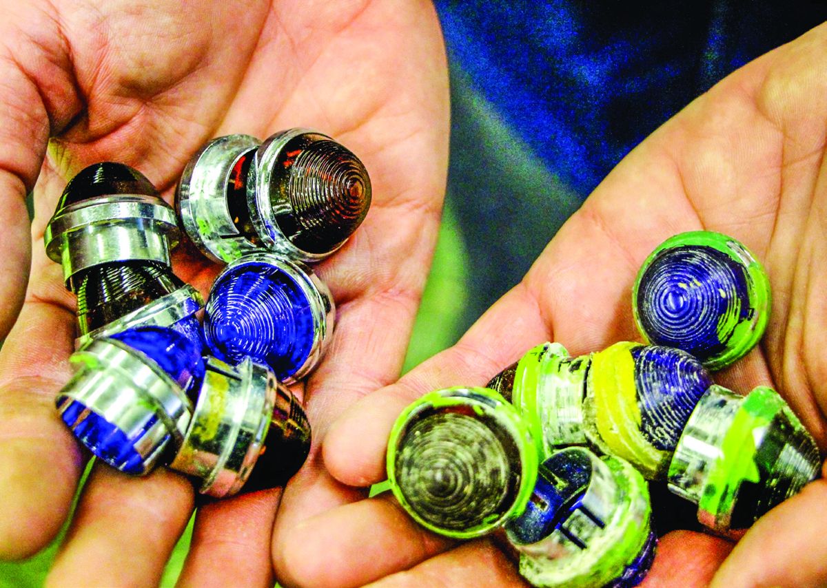
Roland emphasizes that many people have let him know how important it is to keep the “same look and feel” to the show. “I’m not going to spice up the show; it will be as close to the original as I can make it. I also kept the original lenses. Everything below the lenses is new, but it will look the same.” Many people have expressed excitement upon hearing about the project. A sampling of quotes from a Facebook page. Patricia Petry, now a History teacher in Virginia, said: “I loved the electric map on a school trip in elementary school!” Sandy Dobson said “Our first stop in Gettysburg on our high school trip in 1979 was the map. I was mesmerized by it. That was the start of my Gettysburg fascination. Can’t wait to see it again.” Mickey Martin from Easton, Penn., called it “a must see. Saw it when I was ten years old [and] at least 15 times when I brought people to visit Gettysburg. Some from Australia and Germany and many friends from my area. I’ll be 67 in May and would love to see it again. Thanks for the restoration. I can’t wait.” Jim Doncaster, who grew up in York, Penn., but lives in Knoxville said “It’ll be great to have it up and running again. I was disappointed the NPS didn’t see fit to incorporate it into the new Visitors Center. I’ve seen it a few dozen times, many times on our frequent trips to the battlefield growing up and many times since when I’d bring others to Gettysburg. It was always the perfect way to orient people to the field before going out on it.” The map is located at 22 Carlisle St. in Hanover, Penn. Updates on the project are available on Facebook pages: Gettysburg Electric Map in Hanover, Penn.