
The Source
Atlas To The O.R.s
By Michael K. Shaffer · Originally published May 2016 · p. 12
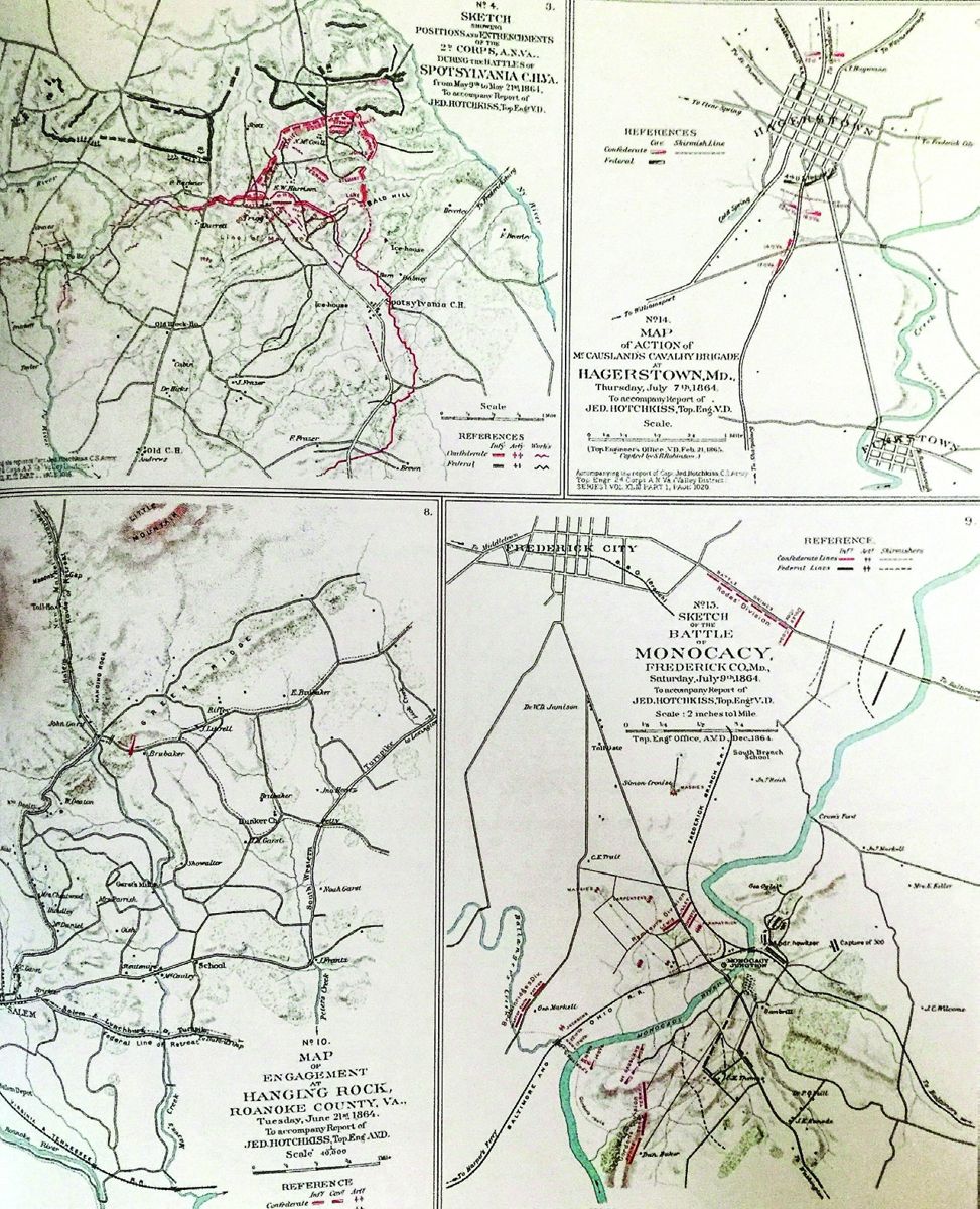
Atlas To The O.R.s Preparing to launch his 1862 Valley Campaign, Major General Thomas J. Jackson turned to his topographer, Jedediah Hotchkiss, and asked him to “…make me a map of the Valley.” Just as generals needed reliable maps (sometimes they held inaccurate maps, and probably would have maneuvered just as well with no maps at all), anyone wishing to conduct research on various Civil War battles needs access to maps. Collecting many of the wartime maps, and redrawing most of them for clarity, resulted in the 1895 publication of The Atlas to Accompany the Official Records of the Union and Confederate Armies. Hotchkiss served as a consultant on the project, but far more Federal maps exist in the Atlas, as many Confederate charts became lost forever because of destruction. Barnes & Noble provided a reprint of the Atlas in 1983, ISBN 0760750440, and copies remain readily available, often for less than $30. A helpful index at the front of this volume will assist in finding specific place-names and battles. (In the original O.R., footnotes referencing the Atlas did not appear until volume 43.) One note to researchers, the Atlas contains various large-scale maps (showing great detail of a small area), and small-scale maps (less detail of a broad region). Many of the scales referenced on the maps do not prove incredibly accurate, so if you wish to learn the true scale, an investigation of the originals in the National Archives might prove helpful. About the National Archives, as with the O.R. aids discussed in the March 2016 edition of this article, users can view the Atlas collection online at https://www.loc.gov/item/03003452/. In 1964, The Archives also published a guide entitled Civil War Maps in the National Archives; remember to use (WorldCat http://www.worldcat.org/) for help in finding a copy of this work - and other books referenced in this article - in your local library. Various Civil War maps exist online, and one can view many of them from the main ‘Civil War Map’ page of the National Archives, https://www.loc.gov/collections/civil-war-maps/. The Civil War Trust provides a series of helpful maps at http://www.civilwar.org/; conduct your own Internet search to locate even more! Four different sections comprise the Atlas. Maps detailing military operations opens the collection; topographic maps of the United States follow; next, maps showing the various military departments; and a section of miscellaneous material completes the work. This final part includes sketches of uniforms, insignia, flags, and some photographs from the war. Lieutenant Daniel Cowles, working in the War Records Office, tried to arrange the maps in chronological order, but despite his best intents, finding specific maps can prove challenging. To help researchers, a few guides to using the Atlas exist. The same tool referenced in an earlier article provides some tips to navigating through the Atlas: Alan, C., and Barbara A. Aimone. A User’s Guide to the Official Records of the American Civil War. Shippensburg, PA: White Mane Pub., 1993. In addition, although out of print, if you can find a copy of Noel S. O’Reilly, David C. Bosse, and Robert W. Karrow Jr., Civil War Maps: A Graphic Index to the Atlas to Accompany the Official Records of the Union and Confederate Armies (Chicago: Newberry Library, 1987), this work will prove valuable in your research. In the introduction, the authors noted, “The entry for New Hope Church, Georgia, lists fifteen maps. These represent five different localities of the same name, with no indication of the engagements fought at New Hope Church from May 25 to June 4, 1864.” This offers an excellent explanation for why their resultant work proves so useful! Civil War Maps: A Graphic Index lists each state individually, and the various boxes and symbols on each map quickly direct researchers to the corresponding maps in the Atlas. Staying with New Hope Church, page 20 of the Graphic Index lists the various large-scale maps found in the Atlas concerning Georgia. Knowing (or discovering) New Hope Church rests in Paulding County will direct the user’s attention
Wine Cork Mortars Shoots corks with real black powder!
Cover of Civil War Maps: A Graphic Index.
to several maps, for example, 43:5, 48:3, etc. The first number points to the respective plate in the Atlas (earlier editions of the Atlas used Roman numerals), and the second number lists the exact map on the plate. Most plates (think of plates in the Atlas as page numbers) contain many maps, so time spent with the Graphic Index will strengthen your research efforts! Many other books containing various maps - including battle specific treatments - exist, with more appearing almost weekly; following, a list of some of the more helpful of these newer, general editions. Aaron Sheehan-Dean, Concise Historical Atlas of the U.S. Civil War (New York: Oxford University Press, 2009). Atlas for the American Civil War, ed. Thomas E. Griess, The West Point Military History Series (Garden City Park, NY: Square One Publishers, 2002). Craig L. Symonds, A Battlefield Atlas of the Civil War, 3rd ed. (Baltimore, MD: Nautical and Aviation Pub. Co. of America, 1983). John Carl Nelson, Atlas of the American Civil War: National Overview (Alexandria, VA: World History Maps, 2010). John Carl Nelson, Atlas of the American Civil War: Army Organization (Alexandria, VA: World History Maps, 2011). Mark Swanson, Atlas of the Civil War, Month by Month: Major Battles and Troop Movements (Athens: University of Georgia Press, 2004). Stephen G. Hyslop, ed., Atlas of the Civil War: A Comprehensive Guide to the Tactics and Terrain of Battle (Washington, D.C: National Geographic Society, 2009). Steven Woodworth and Kenneth J. Winkle, Oxford Atlas of the Civil War (New York: Oxford University Press, 2004). Next month, we will continue to explore other primary source materials, and please continue to send suggestions for future ‘The Source’ columns to the email address shown below. Good luck in your quest to learn more! Michael K. Shaffer: a Civil War historian, author, lecturer, and instructor, remains a member of the Society of Civil War Historians, Historians of the Civil War Western Theater, and the Georgia Association of Historians. Readers may contact him at [email protected], or request speaking engagements via his website www.civilwarhistorian.net. Follow Michael on Facebook www.facebook.com/michael.k.shaffer and Twitter @michaelkshaffer.